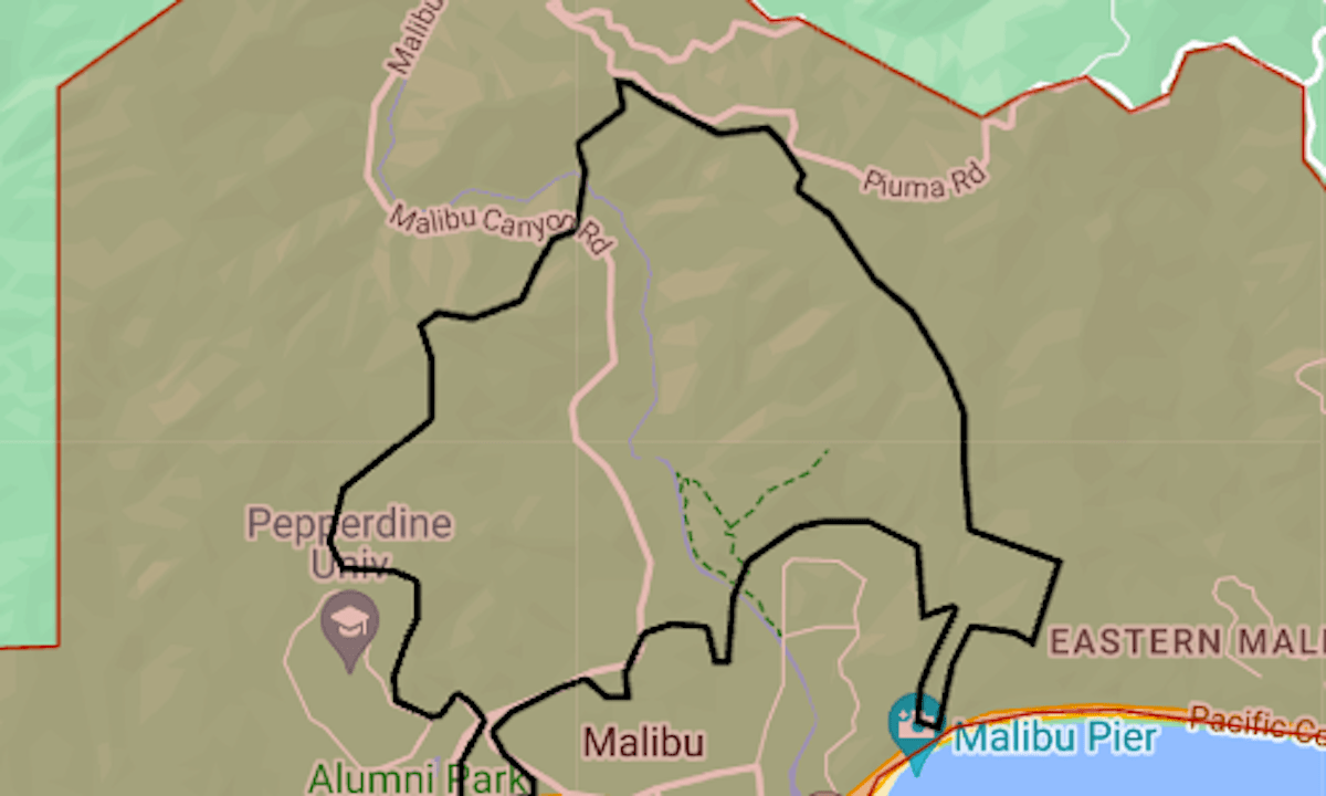
Map: Franklin Fire evacuation in Malibu
A wildfire reported around 11 p.m. Monday, Dec. 9, has prompted evacuations in Malibu and a shelter-in-place order at Pepperdine University.
Related Articles
How to prepare for a wind storm: Charge your devices, trim your trees and secure Santa
Brush fire breaks out in Malibu amid Red Flag conditions; some residents ordered evacuated
Damage claims from the Airport fire run the gamut — from millions for burned houses to $3 for M&Ms
Controlled burn planned for San Mateo County coast
How this California home was retrofitted top to bottom to protect against wildfires — for free
The Franklin Fire broke out during a night of Santa Ana winds in the Los Angeles area. The National Weather Service had issued a red-flag warning designating a “particularly dangerous situation” until Tuesday afternoon in mountainous areas from Ventura to the San Gabriel Mountains.
Shortly before sunrise Tuesday, the fire’s area was estimated at 1,800 acres (2.8 square miles).
The map above shows the mandatory evacuation area in red, with the approximate fire perimeter indicated by the black line.
Pepperdine said much of the campus was without power. Final exams scheduled for Tuesday were postponed.
For updates on evacuations, including warning zones, see the Genasys Protect map or the Los Angeles County emergency website.