Rain and bigger ocean waves are on tap for Bay Area; only the waves will make a lengthy stay
A cold front without a lot of punch from the Gulf of Alaska is expected to bring another round of light rain to the Bay Area on Friday before leaving a long stretch of sunny weather in its wake, according to the National Weather Service.
To hear the agency tell it, that’s not the most significant development.
“The bigger story,” NWS meteorologist Nicole Sarment said, “is what’s going to happen at the beach.”
Related Articles
Capitola Wharf survives mother nature’s first big test since reopening
Man found trapped in Santa Cruz storm debris identified
Cold snap continues in Bay Area this week
Evacuation orders lifted in San Leandro
Sunnyvale City Council approves Severe Weather Hotel Pilot Program
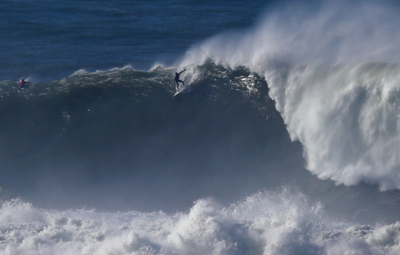
Along with the rain and subsequent high-pressure build-up will be what the weather service called a “long period westerly to northwesterly swell” that will affect the surf along the entire Northern California coast. It is expected to last at least into early next week, according to the weather service.
“There could be a beach hazard warning or a high-surf advisory,” Sarment said, adding that the weather service is keeping an eye on the situation. “The swells are going to be moderate.”
The weather service emphasized that under all conditions, beach-goers never should turn their back to the ocean. Under a beach hazard warning, travelers to the beach are urged to be cautious and to think twice before swimming. Under a high-surf advisory, they are advised to stay away from the beach altogether.
The weather figures to be the kind that draws people to the beach. Sarment said that after rain on Friday and an overcaste Saturday, a stretch of weather that’s “dry to the foreseeable future” will kick off. High pressure is expected to build during that period, and high temperatures are expected to reach into the low 60s in the South Bay and high 50s in the East Bay.
The overnight lows also are expected to come up into the 40s, a change from the extreme cold that has been present in the past week.
The rain on Friday is not expected to be heavy. Sarment said the East Bay is expected to get no more than a quarter-inch in most places, though areas in high elevations in the interior may see up to a half-inch. The South Bay is not expected to get more than a quarter-inch.
The North Bay is likely to see between a quarter-inch and a half-inch, according to the weather service.
“It’s not going to be real impactful for the majority of people other than some wet roads,” Sarment said. “You probably won’t want to have a picnic outside.”


