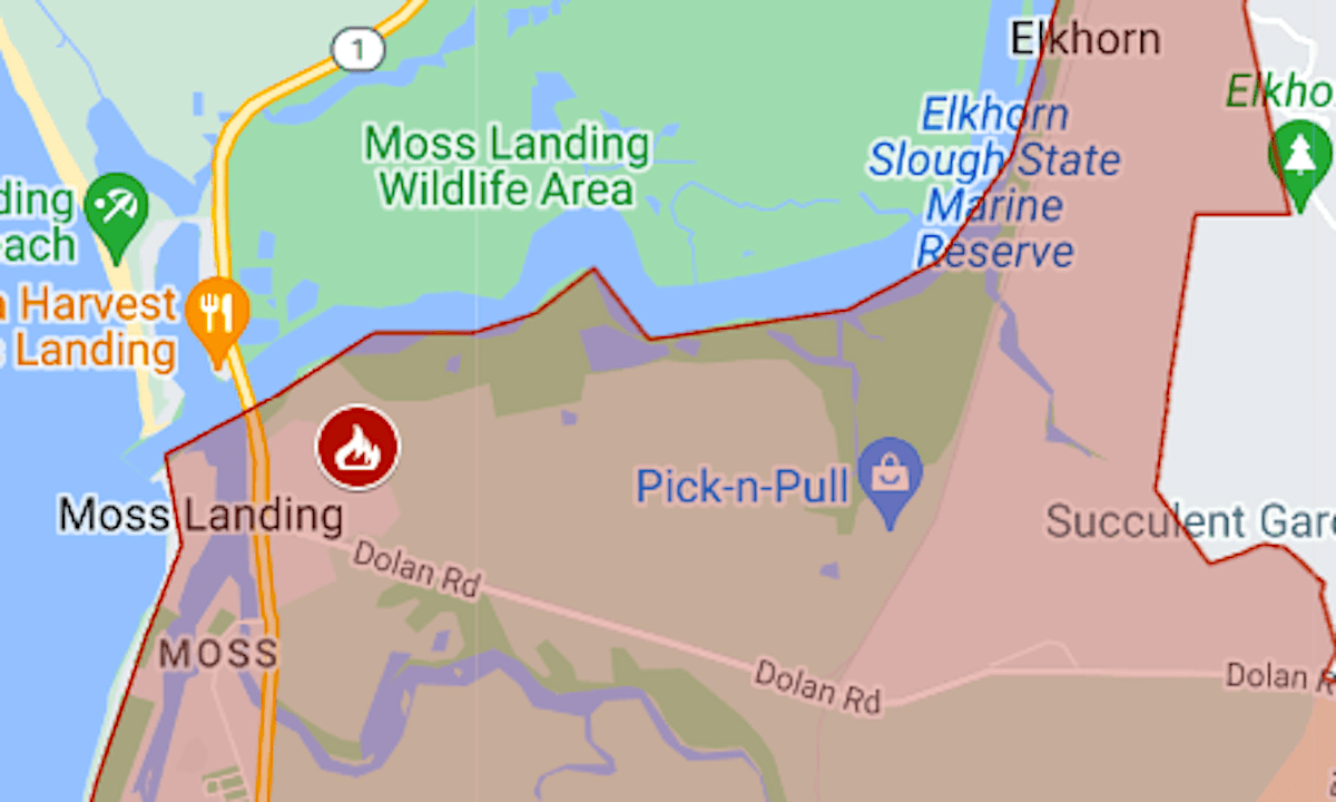
Map: Moss Landing fire evacuation
The community of Moss Landing was evacuated Thursday night because of a fire at a battery storage plant.
Related Articles
36 people still missing in wake of Palisades, Eaton fires
Elias: Any blame for L.A. fires mainly belongs to bad choices decades ago
Huge fire at Moss Landing battery plant spurs evacuations, road closures, sends out plumes of toxic smoke
Wildfires: How older residents can be prepared for danger
How one Bay Area community prepares its elderly residents for deadly wildfire
The orders were issued around 7 p.m. Jan. 16 and covered 8 square miles south of Elkhorn Slough. The map above shows the evacuation area in red.
The Castroville Recreation Center was serving as a temporary evacuation point. Highway 1 was closed between Struve Road and Merritt Street (Highway 183).
The evacuation order remained in effect early Friday. For updates and more details, see the Genasys Protect map.


