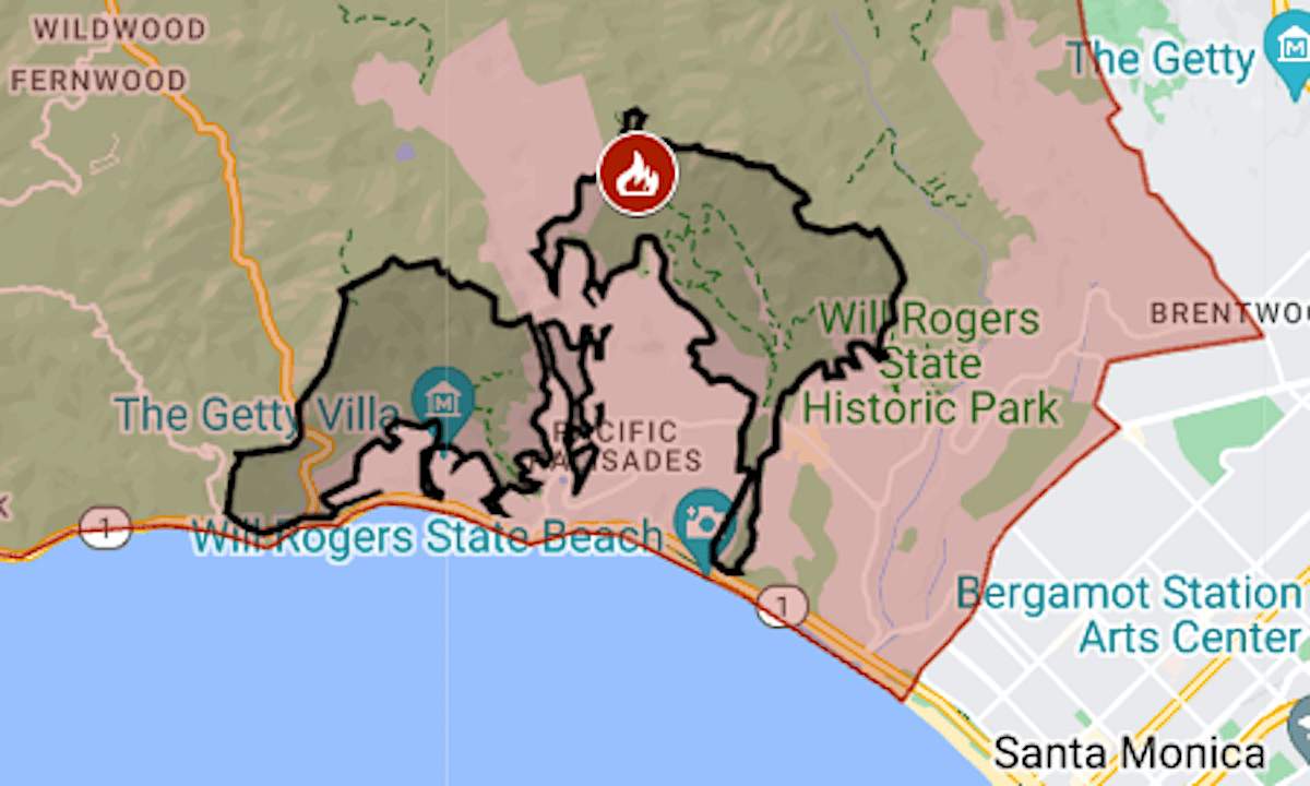
Map: Palisades Fire evacuation zone is expanded
The evacuation zone for the Palisades Fire continued to expand in the early hours of Wednesday, sending tens of thousands of Los Angeles County residents from their homes.
Related Articles
Eaton fire doubles overnight to 2,227 acres — 20 homes lost, evacuations ordered for La Canada Flintridge
Map: This is where the Hurst fire is burning in Southern California
What exactly is a red flag warning? What are mountain waves? What you need to know
Palisades fire burns Getty Villa grounds, but collections are said to be safe
Eaton Fire: Amid wild winds, flames, debris and uncertainty, evacuees find shelter at Pasadena church
The order covers 70 square miles, from Mulholland Drive to the ocean and from Malibu to within a mile of Interstate 405.
The fire, which was reported around 10:30 a.m. Tuesday, Jan. 7, in the Pacific Palisades neighborhood, burned almost 3,000 acres (4½ square miles) in its first eight hours, the Los Angeles Fire Department said.
The map above shows the evacuation area in red and the approximate perimeter as a black line. For updates and details, including the warning areas, see the Genasys Protect map or the Los Angeles County emergency site.
Palisades is the largest of the wildfires burning in the Los Angeles area as high winds sweep the region.


