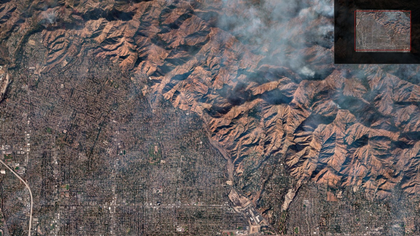
Satellite image shows whole communities destroyed by Eaton fire
Satellite photos released via Maxar’s Open Data Program show the destruction wrought by the Eaton fire, which has charred more than 14,000 acres and damaged or destroyed more than 7,000 structures since it started.
The images, compiled here into an interactive, zoomable map, were taken Jan. 10, 2025 at 10:36 a.m.
• Also see: Map: LA County database shows status of buildings in Eaton fire
Related Articles
Lawsuits blame utility companies for Eaton and Palisades fires
Can Newsom improve rebuilding odds in fire-ravaged Los Angeles?
Wildfire smoke from the LA fires is a hidden health cost
Why FBI sought Ben Affleck’s help amid Los Angeles fires
Oscars push back nominations announcement amid California wildfires


